~/ancient-history/mythology
Did Odysseus Discover America? The Source Dossier
Could Odysseus have reached America? A source dossier on Homer, Plutarch, Atlantic islands, Newfoundland, and Bay of Fundy.
TL;DR
- The Odyssey’s strangest west-Ocean episodes are easier to read as outer-Atlantic material than as a tidy Mediterranean itinerary.
- The strongest Homeric clues are the Laestrygonian long-day passage, the Cimmerian fog at Ocean’s edge, and Charybdis as a periodic whirlpool that exposes the seabed (Homer, Odyssey 10-12).
- Greek and Roman authors did preserve a wider dossier of Atlantic islands, blessed western lands, and even “opposite continent” language, especially in Plato and Plutarch.
- Newfoundland, the Grand Banks, and the Bay of Fundy supply the kind of physical analogues the poem asks for: fog, northern light, cliffs, and violent tides.
- The case is strongest when treated as layered source memory: not “Odysseus sailed from Troy to Boston,” but “Homer inherited older voyage motifs that may have come from Atlantic stories.”
“A time will come when Ocean loosens the bonds of things, when the vast earth lies open, when Tethys reveals new worlds, and Thule is no longer last.”
- Seneca, Medea 375-379, my translation from the Latin tradition preserved in Seneca’s play
What Is Actually Being Claimed? #
The serious version of this question does not start with a fake artifact. It starts with a literary problem: many ancient Greek and Roman sources imagine lands beyond Ocean, and some of the Odyssey’s strangest episodes fit the North Atlantic better than they fit a normal Mediterranean map.
That is the right way into the question. The wrong way is to force every stop in the Odyssey into a single travel itinerary from Troy to Ithaca. Homer is not a logbook. The poem is a late crystallization of older song material, mythic cosmology, sailor lore, and local storytelling. A route can be historically meaningful without being continuous. A monster can preserve a physical hazard after centuries of poetic distortion.
This article therefore follows the strongest version of the claim:
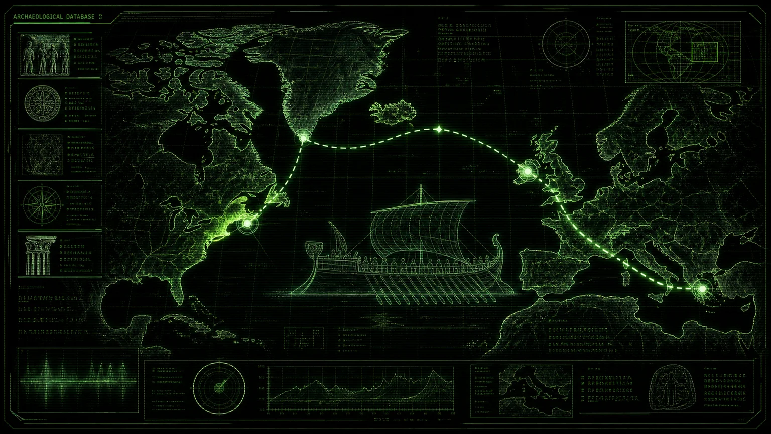
The Odyssey and later classical geography preserve a cluster of outer-Ocean traditions that line up with real North Atlantic routes, islands, fog banks, tidal hazards, and continental land beyond the western sea.
That puts this beside, but not inside, the broader debate surveyed in Pre-Columbian Trans-Oceanic Contact and Phoenicians in the Americas. Those articles ask whether contact happened. This one asks what the ancient texts actually say before anyone maps them onto America.
The Odyssey Passages That Earn a Hearing #
The Odyssey’s Atlantic case lives mostly in Books 10-12. The poem first moves from normal raiding and island adventure into far stranger geography: extreme daylight, loss of east-west orientation, Oceanic genealogy, a fog-bound land of the dead, and a tidal monster.
| Odyssey passage | Locator | My working translation | Why it matters |
|---|---|---|---|
| Laestrygonian daylight | 10.80-86 | “There the paths of night and day draw near; a sleepless man could earn two wages.” | This is the cleanest northern-latitude clue. It does not sound like Sicily or Malta. |
| Laestrygonian harbor | 10.87-96 | “The harbor lay under sheer cliffs, with narrow headlands facing one another at the mouth.” | The harbor is fjord-like: enclosed, cliff-walled, dangerous once entered. |
| Laestrygonian attack | 10.118-132 | “They hurled man-sized stones from the cliffs; ships shattered, and men were speared like fish.” | The danger comes from cliffs above an enclosed anchorage, not from an open beach. |
| Circe’s Oceanic bloodline | 10.133-139 | “Circe and Aeetes were children of Helios and Perse, whom Oceanus begot.” | Circe is not just a witch on a map. She belongs to the solar-Oceanic edge of the world. |
| East-west confusion | 10.190-193 | “We do not know where dusk is, nor dawn; where the sun goes under the earth, nor where it rises.” | Odysseus admits orientation failure. That is exactly what a later Mediterranean editor would try to domesticate. |
| The “long days” formula | 10.466-474 | “When the months waned and the long days had come full circle…” | It marks a year passing on Aeaea; paired with the Laestrygonian daylight, it keeps the episode in a seasonal northern register. |
| Voyage across Ocean | 10.503-540 | “Cross Ocean’s stream; beach the ship by Persephone’s groves; then go to Hades’ house.” | The underworld episode begins by crossing Ocean, not by sailing to a normal Greek island. |
| Cimmerian fog | 11.1-22 | “Ocean brought us to the Cimmerians, wrapped in mist and cloud; the bright sun never looks on them.” | Newfoundland and the Grand Banks are famous for fog, and the image works better there than in a clear Mediterranean setting. |
| Aeaea as sunrise land | 12.1-4 | “Aeaea holds Dawn’s dwelling and dancing grounds, and the risings of the sun.” | This complicates a simple westward reading. Homeric geography is mythic, layered, and not cartographic. |
| Charybdis | 12.101-110 | “The lower cliff bears a leafy fig; beneath it Charybdis sucks black water three times daily.” | A periodic sea hazard under cliffs with a tree marker reads like tidal language rather than volcanic language, though no ordinary tide runs three times a day. |
| Exposed seabed | 12.234-243 | “Spray flew to both cliffs; when she sucked the sea down, the seabed showed black with sand.” | This is the image behind the Bay of Fundy comparison: big-tide coasts expose sea floor on a scale the Mediterranean cannot. In Homer, though, the bottom shows inside the whirlpool, not across a tidal flat. |
| Return to the whirlpool | 12.426-446 | “At sunrise I reached Scylla’s cliff and Charybdis, and clung to the tall fig like a bat.” | The scene is spatially coherent: cliff, tree, recurrent whirlpool, and a predictable wait before the sea returns. |
The Laestrygonians do not require America. Northern Norway, the Faroes, Iceland, or other high-latitude Atlantic settings all fit the daylight clue better than the Mediterranean. The Cimmerians, however, push the imaginative route farther: a land reached by Ocean, wrapped in fog, where the sun is hidden. That is why Newfoundland enters the picture.
Why Newfoundland Enters the Argument #
Newfoundland is not being smuggled in by wishful thinking. It has three traits that matter for this source problem.
First, the Grand Banks and Newfoundland coast sit in a fog machine. Modern summaries explain the fog as a meeting zone where cold Labrador Current water and warmer air or water systems interact; the region is routinely described as one of the foggiest marine areas in the world (CBC News; Formby-Fernandez et al. 2025). That makes Homer’s Cimmerians – “mist and cloud” at Ocean’s edge – physically legible in a way that many Mediterranean identifications are not.
Second, Newfoundland is the one North American endpoint that already belongs to a proven medieval North Atlantic route. Norse presence at L’Anse aux Meadows is hard evidence that the route was real: UNESCO identifies it as the first known European settlement in the New World, and a 2021 Nature study dated Viking activity in Newfoundland to AD 1021 (UNESCO, Nature).
Third, experimental archaeology shows that small, pre-modern North Atlantic craft could survive the route. Tim Severin’s 1976-77 Brendan Voyage crossed by way of Ireland, the Faroes, Iceland, Greenland, and Newfoundland in a leather curragh (Internet Archive record). That matters for Homer because it removes the lazy objection that a northern Atlantic crossing by small pre-modern craft is inherently absurd.
Charybdis and the Bay of Fundy #
Henriette Mertz’s The Wine-Dark Sea made the Bay of Fundy the most famous modern target for Charybdis. The idea has weaknesses when it tries to map the whole Odyssey as a continuous voyage, but the Charybdis comparison is the strongest part of the book.
The Homeric details are specific:
- Charybdis is periodic.
- She sucks water down and later vomits it back.
- The seabed appears black with sand when the water falls.
- The hazard is associated with cliffs and a tree.
- It is dangerous enough to destroy ships but not so supernatural that the physical pattern disappears.
Bay of Fundy tides are among the largest on Earth. Parks Canada gives a range of up to 12 metres at Fundy National Park, where low water exposes more than a kilometre of tidal flats, and the range grows toward the head of the bay (Parks Canada). Near the mouth of the bay, between Deer Island, New Brunswick, and Eastport, Maine, Old Sow is a real tidal whirlpool system. It turns over a seabed trench as deep as about 120 metres, is most active a few hours before high tide, and produces gyres, troughs, spouts, and holes (Bay of Fundy).
The comparison works in pieces, not as a single place. The drained flats of the upper bay and the whirlpool at its mouth are different features, and Old Sow churns over deep water rather than baring the bottom. Homer’s Charybdis also turns three times a day, while Fundy’s tides turn twice. What Fundy supplies is the combination the Mediterranean lacks: a sea that visibly drains and returns on a schedule, and a whirlpool turbulent enough to earn a name. If Charybdis preserves a sailor’s memory of big-tide waters, it is a memory of this kind of coast, compressed into one monster.
The Ancient Outer-Ocean Dossier #
The ancient evidence falls into four different categories:
- Mythic western blessed lands.
- Reports of Atlantic islands beyond the Pillars.
- Explicit “great land” or “opposite continent” language.
- Later Roman geographic systematization of Fortunate Isles, Canaries, Thule, and Atlantic periploi.
| Source | Locator | Passage that earns it a place | Category |
|---|---|---|---|
| Homer, Odyssey | 10-12 | Long-day Laestrygonians, Ocean-crossing to the dead, Cimmerian fog, and Charybdis exposing seabed. | North Atlantic analogues inside epic myth |
| Hesiod, Works and Days | 167-173 | Heroes live “at the ends of the earth” on Isles of the Blessed beside deep Ocean; the earth bears fruit three times yearly. | Western blessed land |
| Pindar, Olympian 2 | 68-83 | The purified dwell with Cronus where “Ocean breezes” blow around the Island of the Blessed. | Western blessed land |
| Plato, Timaeus | 24e-25d | Atlantis lies before the Pillars; from it voyagers can cross to other islands and then to the “opposite continent” around the true sea. | Great land beyond Atlantic islands |
| Plato, Critias | 108e-109a | The Atlantis story is resumed as a primordial Atlantic war framed around lands outside the Pillars. | Atlantis reception |
| Ps.-Aristotle, On Marvellous Things Heard | 84 / 837a | Carthaginians discover a deserted island outside the Pillars, wooded, rivered, fruitful, and then restrict access. | Secret Atlantic island |
| Diodorus Siculus, Library | 5.19-20 | Phoenicians blown far west find a fertile Atlantic island with rivers, fruit, and luxurious landscape, and make it known to all; Carthage later blocks a Tyrrhenian (Etruscan) colony there. | Phoenician/Carthaginian Atlantic island |
| Diodorus Siculus, Library | 2.47 | Beyond the Celts, in the northern Ocean, lies a large Hyperborean island with a round temple of Apollo. | Northern Ocean island |
| Pytheas via Strabo | Strabo 1.4.2 | Thule is six days north of Britain, near the frozen sea; Strabo preserves the claim while doubting Pytheas. | Northern Ocean exploration |
| Strabo, Geography | 1.4.6; 2.3.6 | Strabo discusses oceanic passage, inhabited worlds, Atlantis, and Atlantic limits while criticizing over-bold geography. | Scholarly reception |
| Plutarch, De Facie | 941A-C | Ogygia lies five days west of Britain; farther islands lead toward a great mainland encircling the ocean. | Strongest “great mainland” text |
| Plutarch, Sertorius | 8-9 | Sailors tell Sertorius of two Atlantic islands, ten thousand stadia from Africa, identified with the Isles of the Blessed. | Fortunate Isles |
| Plutarch, De Defectu Oraculorum | 419E-420A | Around Britain are sacred daemon-islands; Cronus sleeps imprisoned on one. | Northern sacred islands |
| Aelian / Theopompus, Varia Historia | 3.18 | Europe, Asia, and Libya are islands surrounded by Ocean; beyond them lies one immense continent, Meropis. | Outer continent myth |
| Pomponius Mela, Chorographia | 3.102 | The Fortunate Isles lie opposite sandy Africa and feed inhabitants without labor. | Roman Fortunate Isles |
| Seneca, Medea | 375-379 | Ocean will loosen the world; a vast land will open; Thule will no longer be last. | Literary prophecy of western discovery |
| Pliny the Elder, Natural History | 6.202-205 | Sebosus and Juba enumerate Fortunate Isles: Ombrios, Junonia, Capraria, Ninguaria, Canaria. | Roman island catalog |
| Ptolemy, Geography | Book 1 | The Fortunate Isles function as the western zero-meridian of Ptolemy’s mapped world. | Geographic systematization |
| Avienus, Ora Maritima | 90-129; 370-410 | The Oestrymnides are tin and lead islands; Himilco reports sluggish, weeded, difficult Atlantic waters. | Western/northern periplus tradition |
| Solinus, Polyhistor | 56 | Solinus repeats and elaborates Fortunate Isles material: Ombrios, Junonia, Capraria, Nivaria, Canaria, fruit, birds, and honey. | Late Roman redaction |
| Proclus / Marcellus | Commentary on Timaeus | Marcellus reports outer-sea island traditions tied to Atlantis, including seven islands and three huge ones. | Late antique Atlantis reception |
Two entries are doing the heaviest work: Plato’s “opposite continent” and Plutarch’s “great mainland.” The rest are not useless, but most are island traditions. They show that Greeks and Romans had a durable symbolic geography of the far west. They do not, by themselves, identify America.
Primary Text Blocks: Working Translations #
The table above tells us where to look. The next table gives the words that make the dossier worth taking seriously. These are working translations made for this article; the linked editions give the surrounding context.
| Source | Direct working translation | What it adds to the case |
|---|---|---|
| Homer, Odyssey 10.80-86 | “There the paths of night and day draw near one another. A man who could go without sleep might win two wages: one by herding cattle, another by pasturing pale sheep; for the goings of night and day are close.” | High-latitude daylight is the most concrete Homeric clue. It points away from the central Mediterranean and toward northern Ocean. |
| Homer, Odyssey 11.13-19 | “There is the land and city of the Cimmerian people, wrapped in mist and cloud. Never does the shining sun look upon them with his rays, not when he climbs the starry sky, not when he turns back from heaven toward earth; destructive night lies stretched over wretched mortals.” | A fog-bound, sunless land at Ocean’s edge is exactly the image that makes Newfoundland and the Grand Banks relevant. |
| Homer, Odyssey 12.235-243 | “When she vomited it out, like a cauldron over a great fire she seethed and roared; spray fell on the tops of both cliffs. But when she swallowed the salt sea down, she showed the sand below, dark and blue-black, and the rock thundered terribly around her.” | Charybdis is a tidal description before it is a monster description: periodic water movement, exposed bottom, cliffs, and roar. |
| Hesiod, Works and Days 167-173 | “Far from the deathless gods, the son of Cronus settled them at the ends of the earth. They live untouched by sorrow on the Isles of the Blessed beside deep-swirling Ocean; for them the grain-giving earth bears honey-sweet fruit three times a year.” | The far-western paradise by Ocean is already archaic Greek material, not a later medieval fantasy. |
| Pindar, Olympian 2.68-83 | “Those who have dared three times on either side to keep their souls from injustice travel the road of Zeus to the tower of Cronus. There Ocean breezes blow around the Island of the Blessed, and flowers of gold blaze.” | Pindar fixes the blessed western island complex in elite Greek poetry, with Cronus and Ocean together. |
| Plato, Timaeus 24e-25a | “At that time the sea there was passable. In front of the mouth which you call the Pillars of Heracles lay an island larger than Libya and Asia together. From it travelers could pass to the other islands, and from those islands to the whole opposite continent surrounding that true sea.” | This is the cleanest classical “islands, then continent” passage beyond the Atlantic gate. |
| Ps.-Aristotle, On Marvellous Things Heard 84 | “They say the Carthaginians found an island in the Ocean outside the Pillars of Heracles: uninhabited, wooded with every kind of tree, crossed by navigable rivers, and full of fruits. It lay several days’ voyage away.” | This is a Punic Atlantic discovery story: island, rivers, woods, fruit, and secrecy. |
| Diodorus Siculus, Library 5.19-20 | “Opposite Libya, out in the Ocean, there is an island of considerable size, many days’ sailing to the west. Its land is fruitful, much of it mountainous and much level; navigable rivers water it; gardens and many kinds of trees make it fit for delight.” | Diodorus gives the same Atlantic-island tradition a fuller geography and ties it to Phoenician/Carthaginian sailors. |
| Plutarch, De Facie 941A-C | “Ogygia lies five days’ sail west from Britain. Three other islands stand at equal distance from it and from one another, toward the summer sunset. Beyond them lies the great mainland by which the great sea is encircled.” | Plutarch is the strongest ancient text for a northern route through islands to a western mainland. |
| Aelian / Theopompus, Varia Historia 3.18 | “Europe, Asia, and Libya are islands, around which Ocean flows. Outside this world there is one continent alone, boundless in size, where great cities stand and peoples live under different laws.” | Theopompus preserves the same mental architecture: the known world as an Ocean-ringed island, with a greater continent beyond. |
| Seneca, Medea 375-379 | “In later years an age will come when Ocean loosens the bonds of things, the huge earth lies open, Tethys reveals new worlds, and Thule is no longer the last of lands.” | Seneca shows that a western disclosure of new lands was thinkable in Roman literary culture before 1492. |
The Best Ancient Passage Is Plutarch, Not Homer #
If the question is “Which classical text most sounds like North America?”, the answer is not the Odyssey. It is Plutarch’s On the Face Which Appears in the Orb of the Moon.
Plutarch’s speaker places Ogygia five days west of Britain. Beyond it are other islands, and beyond them a “great mainland” surrounding the ocean. The same passage places Greeks around a gulf on that mainland and links the whole complex to Cronus and Carthaginian knowledge (Plutarch, De Facie 941A-C). Sulla frames the whole account as a myth he heard from a stranger, and it ends in a lunar eschatology of souls, so it is not an independent voyage report.
That is the passage modern speculative reconstructions return to. Liritzis and coauthors argued in the Journal of Coastal Research that the astronomical and geographic data in Plutarch can be read as a North Atlantic route toward the Gulf of St. Lawrence and Newfoundland (Liritzis et al. 2018). Even the older mythic/Platonic reading preserved in the Loeb/Thayer introduction helps the case: it shows that Plutarch’s geography was already understood as part of the Atlantis-and-outer-Ocean complex (Thayer introduction). It remains the clearest classical description of an island route to a western mainland, which is why Plutarch belongs at the center of the case, not in a footnote.
The Southern Route: Carthage, Islands, and the Gyre #
The Carthaginian island stories in Ps.-Aristotle and Diodorus are the strongest southern-route material. Both texts tell essentially the same kind of story: ships beyond the Pillars find a rich island in the ocean, and Carthage later controls access to it. In Diodorus the Phoenician discoverers make the island known to all; the Carthaginian policy concerns who may settle there.
Lucio Russo has made the boldest modern technical argument from the geographic side. In “Far-reaching Hellenistic geographical knowledge hidden in Ptolemy’s data,” he argues that Ptolemy’s Fortunate Isles preserve distorted coordinates that originally fit the Lesser Antilles rather than the Canaries (Russo 2018). If Russo is right, the “Isles of the Blessed” tradition may contain a real Caribbean shadow.
The point is not that every Ptolemaic error can be decoded into a hidden voyage. Dmitry Shcheglov’s work on Ptolemy’s longitude error shows why the numbers should not be treated as a simple universal offset (Shcheglov 2016). The point is that Russo gives the island tradition a technical cartographic route into the Caribbean question.
Still, the route mechanics are not impossible. The North Atlantic currents form a clockwise gyre. The Canary Current flanks it on the east, off northwest Africa; the trade winds drive the North Equatorial Current west toward the Caribbean; and the Gulf Stream runs north along the American coast toward Newfoundland at roughly one to three knots before turning northeast into the open Atlantic (NOAA Ocean Service; ESA Eduspace). A ship blown west off the African or Iberian Atlantic would be carried toward the Caribbean, not back home, which is the scenario Diodorus describes. The currents make an involuntary crossing physically plausible; they are not evidence that one happened.
The Northern Route: Pytheas, Thule, Ogygia, Newfoundland #
The northern route is more relevant to the Odyssey material because it explains long days, mist, cold, cliffs, and island-stepping. It runs through the world of Pytheas, not Columbus: Britain, northern islands, Thule, frozen sea, and perhaps farther stepping stones.
Strabo preserves Pytheas’s claim that Thule lay six days north of Britain near the frozen sea, while also mocking Pytheas as unreliable (Strabo 1.4.2). That double preservation is useful. It tells us the Greek tradition had a real northern-Ocean claim early enough to be controversial.
The route becomes physically clearer once later evidence is admitted:
| Segment | Why it matters | Evidence |
|---|---|---|
| Britain to northern islands | Matches Pytheas, Plutarch’s Britain-west frame, and the Odyssey’s high-latitude daylight. | Strabo on Pytheas |
| Iceland/Greenland stepping stones | Makes a North Atlantic crossing a sequence of hard legs rather than one impossible leap. | Severin’s Brendan Voyage |
| Newfoundland | Proven endpoint for later Norse voyagers; fog-rich, Ocean-edge, and symbolically close to the Odyssey’s Cimmerians. | UNESCO L’Anse aux Meadows |
| Bay of Fundy | Extreme tides and a real tidal whirlpool, in different parts of the bay: a partial analogue for Charybdis. | Parks Canada Fundy tides, Old Sow |
This is why the Atlantic reading should not be caricatured as “a Greek ship sailed straight to America.” The better model is a northern oral map: known islands, rumored islands, sacred islands, fog lands, and a great mainland at the far edge.
Why the Whole Itinerary Should Not Be Forced #
The weak versions of the theory try to identify every episode in the Odyssey with one literal place. That makes the poem brittle. If Aeolia is one island, Circe is another, Scylla is a third, and every transition must obey modern sailing logic, the argument collapses as soon as one identification fails.
The stronger version treats the poem as layered material:
- Some episodes are probably Mediterranean.
- Some are mythic and cosmological.
- Some may preserve distant sailors’ reports.
- Some may have been relocated or domesticated by later Greek imagination.
The Aeaea problem proves the need for this approach. Odysseus loses east and west there, and Circe belongs to Oceanic solar genealogy, which helps the Atlantic case. But Book 12 also calls Aeaea the place of Dawn and the sun’s risings, which pulls it toward the east. That placement rules out a continuous westward itinerary, and it is what mythic geography looks like when several symbolic systems have been braided together.
What the Wider Dossier Shows #
Taken together, the sources show three patterns.
First, the Isles of the Blessed are not a late fantasy invented after Columbus. Hesiod and Pindar already place blessed western life by Ocean. Later Roman authors turn the same motif into a geographic island complex.
Second, Carthaginian and Phoenician Atlantic stories are real classical motifs. Ps.-Aristotle and Diodorus give the same core pattern twice: Punic sailors find a rich western island, and access to the discovery is politically controlled.
Third, “continent beyond Ocean” language exists. Plato, Plutarch, and Theopompus via Aelian are the key witnesses. Their contexts differ, but the shared mental map is unmistakable: our world, Ocean around it, islands in the outer sea, and a greater land beyond.
So the question is not whether classical authors had a category for western lands beyond Ocean. They did. The question is whether any of those categories preserve real reports from beyond the mid-Atlantic island world.
Verdict #
Did Odysseus discover America? As a literal Bronze Age news headline, the question is too small. As a mythic label for older Atlantic route memory, it is worth taking seriously.
The case rests on identifiable passages: Homer’s long days and fog land, Charybdis as a tidal sea-hazard, Plato’s opposite continent, the Phoenician and Carthaginian island of Ps.-Aristotle and Diodorus, Plutarch’s great mainland west of Britain, Theopompus’s continent beyond the Ocean-ring, and Seneca’s poetic vision of new worlds beyond Thule. Add the physical geography of the Grand Banks, Newfoundland, the Gulf Stream, North Atlantic stepping stones, and the Bay of Fundy, and the result is no longer a stray resemblance. It is a coherent outer-Ocean pattern.
The best conclusion is therefore simple: the Odyssey may be one of the oldest surviving Greek containers for stories about the outer Atlantic, and later classical authors preserve enough matching geography to keep the America question alive. The texts cannot settle it alone; that would take a secure pre-1492 find in the Americas.
Sources #
- Homer. Odyssey, Book 10, Book 11, and Book 12. Greek epic passages on the Laestrygonians, Circe, Cimmerians, and Charybdis.
- Hesiod. Works and Days, lines 167-173. Isles of the Blessed beside Ocean.
- Pindar. Olympian Odes 2, lines 68-83. Island of the Blessed and Ocean breezes.
- Plato. Timaeus, 24e-25d, and Critias, 108e-109a. Atlantis, outer islands, and the opposite continent.
- Ps.-Aristotle. On Marvellous Things Heard, 84 / 837a. Carthaginian discovery of an Atlantic island.
- Diodorus Siculus. Library of History 5.19-20 and 2.47. Phoenician Atlantic island and Hyperborean northern island.
- Strabo. Geography 1.4. Pytheas, Thule, and ancient skepticism about northern-Ocean claims.
- Plutarch. On the Face Which Appears in the Orb of the Moon, 941A-C. Ogygia west of Britain and the great mainland beyond.
- Plutarch. Sertorius, 8-9. Atlantic Isles of the Blessed.
- Plutarch. De Defectu Oraculorum, 419E-420A. Sacred islands around Britain and sleeping Cronus.
- Aelian. Varia Historia 3.18. Theopompus’s Meropis and the immense continent beyond Ocean.
- Pomponius Mela. Chorographia, 3.102. Fortunate Isles.
- Seneca. Medea, 375-379. Ocean, new worlds, and Thule.
- Pliny the Elder. Natural History, 6.202-205. Fortunate Isles catalog.
- Claudius Ptolemy. Geography. Fortunate Isles as western mapping meridian.
- Avienus. Ora Maritima, 90-129 and 370-410. Oestrymnides and Himilco’s Atlantic.
- Solinus. Polyhistor, 56. Fortunate Isles redaction.
- Proclus. Commentary on Plato’s Timaeus. Marcellus fragment on outer-sea island traditions.
- Lucio Russo. “Far-reaching Hellenistic geographical knowledge hidden in Ptolemy’s data.” Mathematics and Mechanics of Complex Systems 6, no. 3 (2018): 181-200.
- Ioannis Liritzis et al. “Does Astronomical and Geographical Information of Plutarch’s De Facie Describe a Trip Beyond the North Atlantic Ocean?” Journal of Coastal Research 34, no. 3 (2018): 651-674.
- Henriette Mertz. The Wine Dark Sea: Homer’s Heroic Epic of the North Atlantic. 1964.
- Tim Severin. The Brendan Voyage. 1978.
- Birgitta Wallace and UNESCO. L’Anse aux Meadows National Historic Site. UNESCO World Heritage Centre.
- Margot Kuitems et al. “Evidence for European presence in the Americas in AD 1021.” Nature 601 (2022): 388-391.
- NOAA Ocean Service. “Surface Ocean Currents.” North Atlantic gyre and Gulf Stream overview.
- European Space Agency. “The North Atlantic Gyre.” Ocean current overview.
- Parks Canada. “Tides.” Fundy National Park. Tidal range, twice-daily tides, and exposed tidal flats.
- Bay of Fundy Tourism. “Old Sow Whirlpool.” Regional description of the tidal whirlpool system.
- CBC News. “A Mysterious Fog Has Shrouded Newfoundland for Days. Here’s Why.” April 9, 2021. Fog and current explanation.
- Adriana Formby-Fernandez et al. “Spatial and Temporal Structure of the Fog Life Cycle over Atlantic Canada and the Grand Banks.” Quarterly Journal of the Royal Meteorological Society 151 (2025): e4953. Fog climatology study.
- Dmitry Shcheglov. “The Error in Longitude in Ptolemy’s Geography Revisited.” The Cartographic Journal 53, no. 1 (2016): 3-14.